VORTEX-Southeast
MIRSL is partnering with the Purdue University Dept. of Earth Atmosphere and Planetary Sciences to participate in the 2016 Verification of the Origins of Rotation in Tornadoes EXperiment -- Southeast (VORTEX-SE). This experiment focuses on the unique aspects of tornadoes and tornadic storms occuring in the Southeast U.S. VORTEX-SE is a research program to understand how environmental factors characteristic of the southeastern United States affect the formation, intensity, structure, and path of tornadoes in this region. VORTEX-SE will also determine the best methods for communicating forecast uncertainty related to these events to the public, and evaluate public response. In many ways, VORTEX-SE represents a new approach to tornado research in general.
The number of killer tornadoes in the southeastern U.S. is disproportionately large when compared to the overall number of tornadoes throughout the country. Researchers believe this is caused by a series of physical and sociological factors, including tornadoes at night, in rugged terrain, as well as tornadoes occurring before the perceived peak of “tornado season,” during a time of year when storms typically move quickly. Other variables include the lack of visibility, inadequate shelter, and larger population density that increases the vulnerability of residents in this area.
The experimental domain is a region of northern Alabama including the Huntsville area. MIRSL is deploying two instruments for VORTEX-SE:
1. A mobile S-band Frequency-Modulated Continuous-Wave (FMCW) radar that provides vertical profiles of atmospheric reflectivity and vertical velocity with resolution of 5 m and 1 s. This radar, shown at right, operates continuously throughout the campaign to monitor the atmospheric boundary layer structure and evolution. It is sensitive to precipitation/clouds, clear-air turbulence, and insects. Current and past observations are available here.

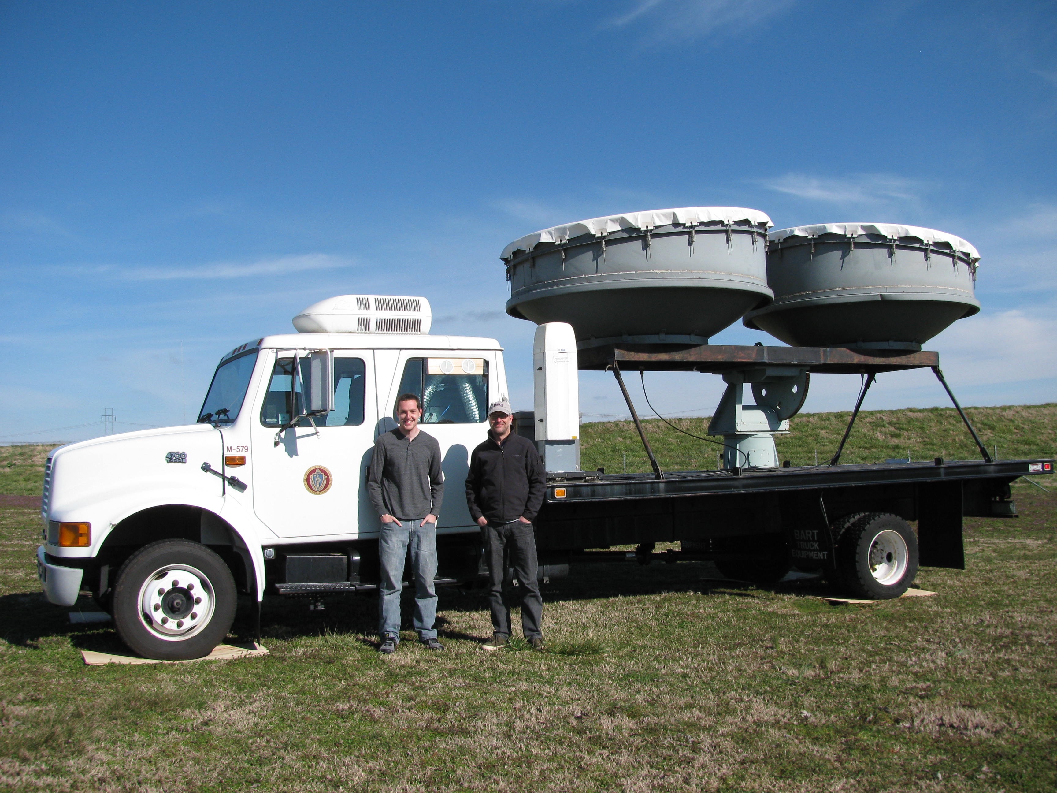
2. A mobile X-band dual-polarized Doppler radar providing storm-scale coverage of severe weather events. This radar, shown at left, is operated during Intensive Observational Periods (IOPs) declared based upon forecast conditions.